|
|
Boston Harbor
and Massachusetts Bay
Massachusetts
Water Resources Authority
MWRA Water Quality Monitoring
Beaches
MWRA assists Massachusetts Department of Conservation
and Recreation (DCR) in testing water quality at Carson, Constitution, Tenean, Pleasure Bay, and Wollaston beaches. |
Boston Harbor & Rivers
The Massachusetts Water Resources Authority's (MWRA) has
been monitoring water quality in Boston Harbor and its tributaries since
1989. MWRA makes at least 20 visits
to each sampling location every year.
Monitoring areas are: Charles River, Mystic River/Alewife Brook, Inner Harbor, Northern Dorchester Bay/Carson
Beach, Southern Dorchester Bay/Tenean Beach, Neponset River, and Quincy Bay/Wollaston
Beach. |
Combined Sewer Overflows
The Combined Sewer Overflow (CSO) monitoring area includes the "receiving waters" of
all CSO communities in greater Boston including the Inner
Harbor, Boston Harbor embayments, and tributary rivers. Measurements include bacteria, nutrients, dissolved oxygen, and water clarity.
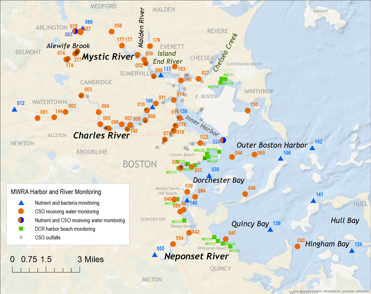
Summary of CSO Receiving Water Quality Monitoring in Upper Mystic River/Alewife Brook and Charles River
CSO Sampling Map
More information on CSOs
|
Data Analysis & Interpretation
Long-term Harbor monitoring helps in identifying
change in water quality over time. Historical results from 1989 to last year for bacteria, nutrients, and other
water quality parameters are available for download in Excel spreadsheets
for Boston Harbor and three tributary rivers. Summaries and technical analysis of MWRA water quality monitoring in Boston Harbor and Massachusetts Bay are available for download on our Technical Reports List.
|
Massachusetts Bay
MWRA's NPDES discharge permit for the Deer Island Wastewater Treatment Plant requires extensive monitoring and reporting. MWRA monitors the effluent (treated sewage) that is
discharged into Massachusetts Bay, to ensure that it meets the standards
set out in the permit. The Bay bacteria monitoring program measures water quality near the outfall to ensure that there is no risk to shellfish consumers. |
Questions? Contact the Environmental Quality Department. |