MWRA online - home
Home
Water System
Sewer System
Harbor and Bay
School Program
About MWRA
Doing Business with MWRA
Contact MWRA


Boston Harbor and Massachusetts Bay

Massachusetts Water Resources Authority

Archive

Environmental Monitoring Data

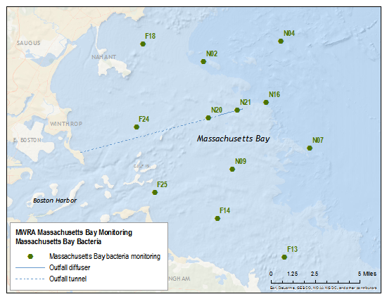
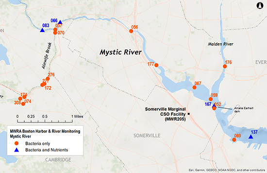
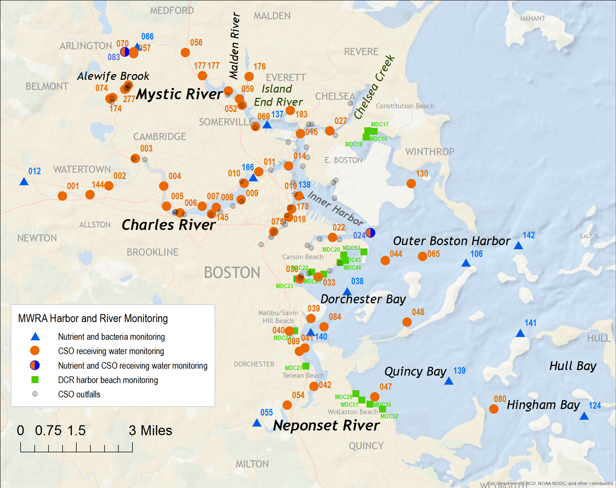
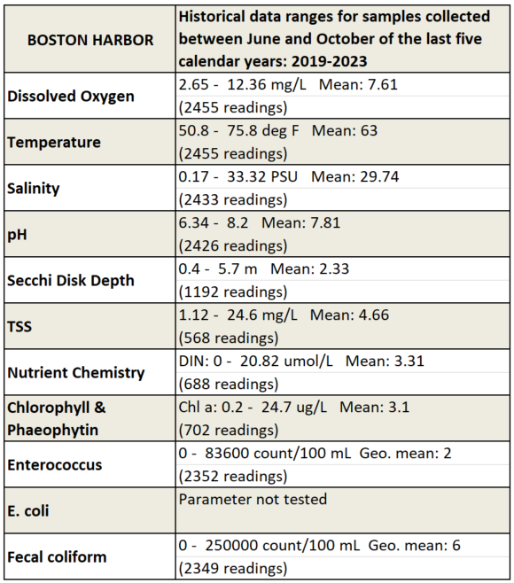
Massachusetts Bay Bacteria: MWRA monitors bacteria at locations surrounding the MWRA outfall and elsewhere in Massachusetts Bay (see station map). Water samples are analyzed for sewage indicator bacteria: fecal coliform and Enterococcus.

Download Massachusetts Bay bacteria data (Excel)

2021 2022 2023 2024          
2011 2012 2013 2014 2015 2016 2017 2018 2019 2020
2005 2006 2007 2008 2009 2010

Map of bacteria monitoring locations.
__________________________________________________________________________
Boston Harbor and Rivers: Boston Harbor is an estuary--a marine ecosystem where fresh water from the rivers enters the ocean. Since 1989, the Massachusetts Water Resources Authority (MWRA) has measured bacteria, algae, water clarity, dissolved oxygen, nutrients, and suspended solids at more than 70 locations in the Harbor and the CharlesNeponset, and Mystic rivers. Download data below.

Boston
Harbor
Neponset
River
Charles
River
Mystic
River
Harbor Map Neponset Map Charles Map Mystic Map
Detailed Sampling location map
Sampling station latitude-longitude locations (Excel)
Harbor Data Summary Neponset Data Summary Charles Data Summary Mystic Data Summary
Download Data (Excel)
Harbor
Physical data
Neponset
Physical data
Charles
Physical data
Mystic
Physical data
Harbor
Clarity
Neponset
Clarity
Charles
Clarity
Mystic
Clarity
Harbor
Nutrients
Neponset
Nutrients
Charles
Nutrients
Mystic
Nutrients
Harbor
Bacteria
Neponset
Bacteria
Charles
Bacteria
Mystic
Bacteria

__________________________________________________________________________

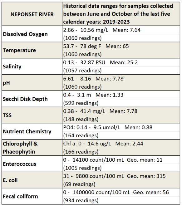
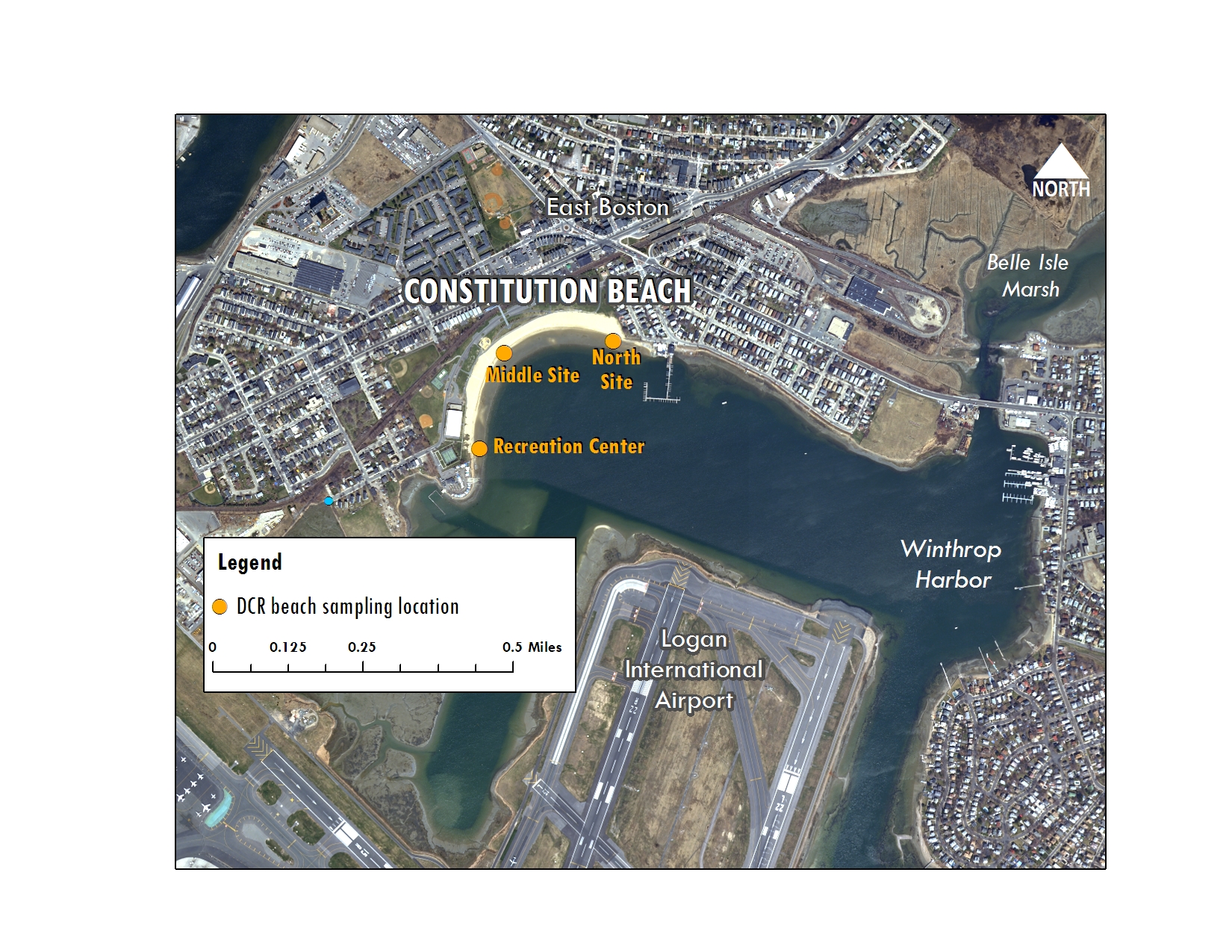
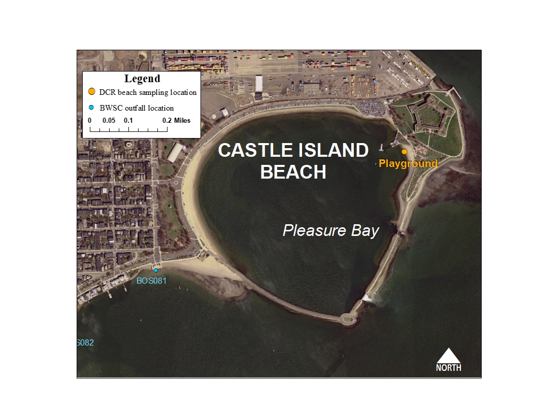
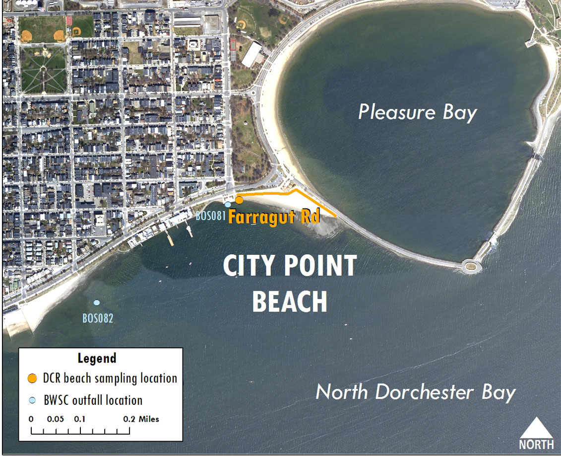
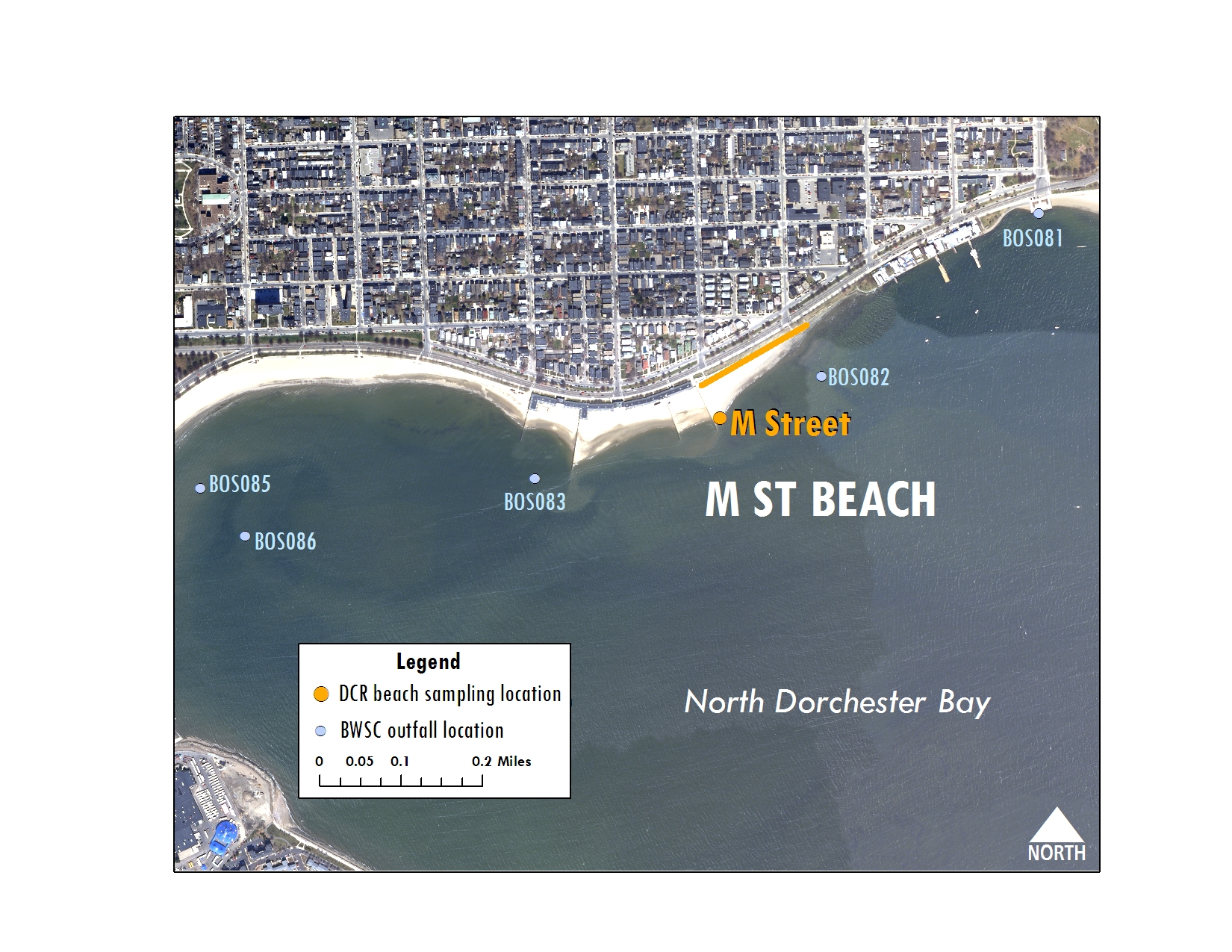
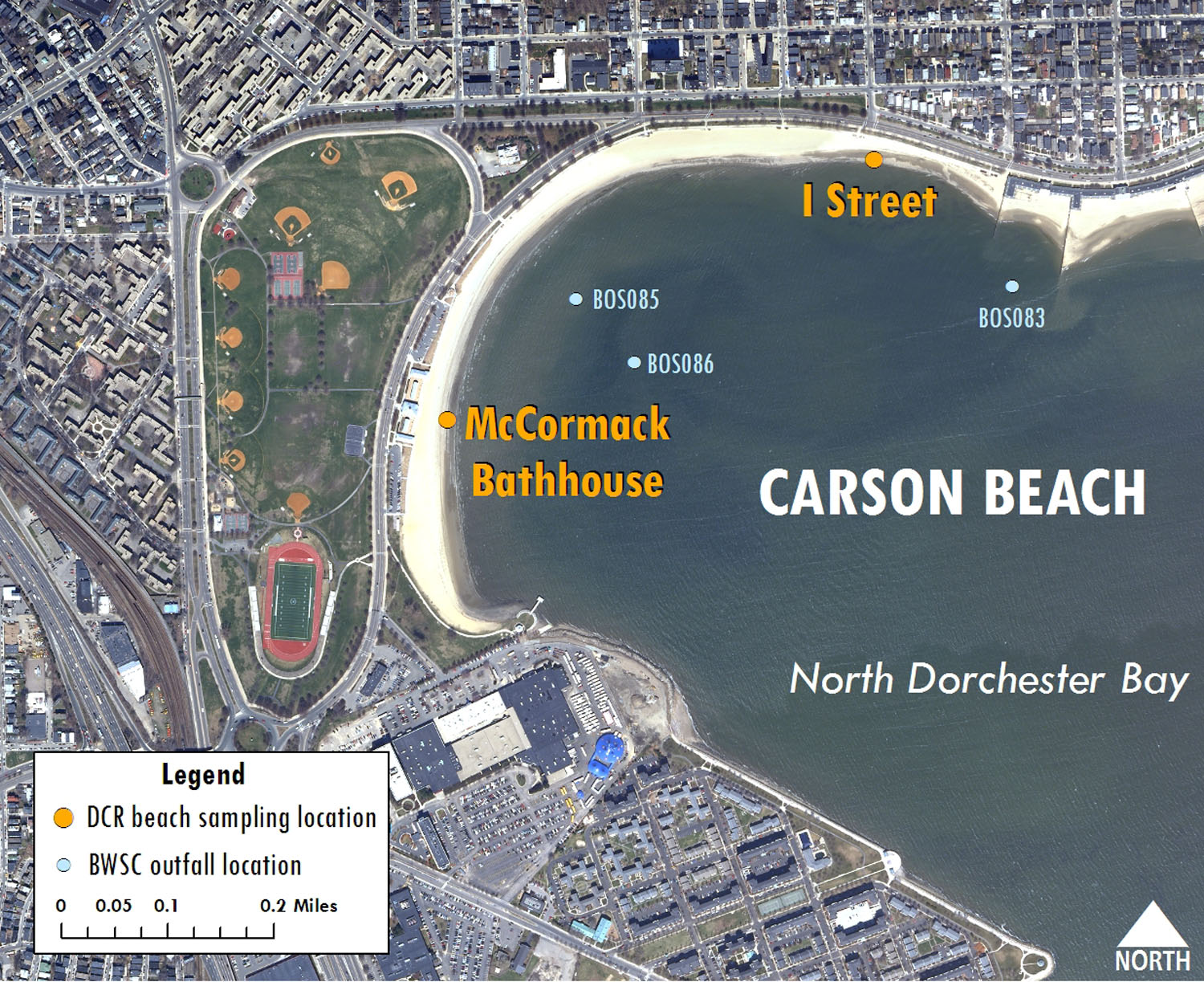
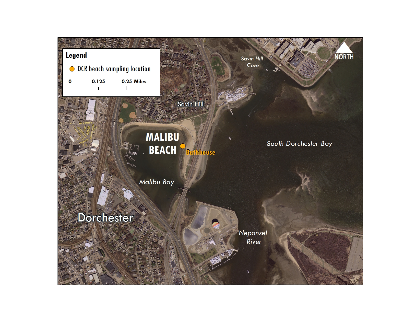
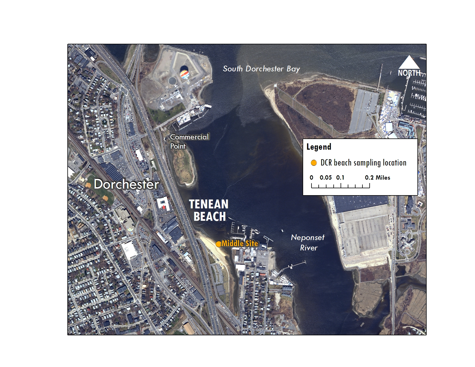
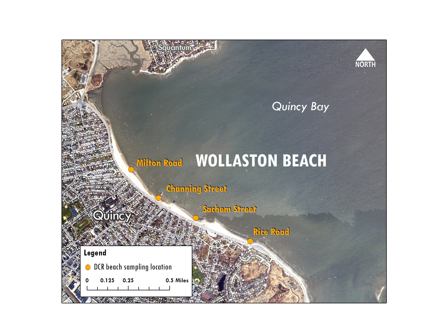
Boston Harbor Beaches: Water quality at Wollaston, Carson, Constitution,Tenean, and Pleasure Bay beaches is tested by the Department of Conservation and Recreation (DCR) with assistance from the Massachusetts Water Resources Authority.

Current public beach postings (May-Sep) are available from the Massachusetts Department of Public Health.
Download historical beach data (last season and older).
Beach Fact Sheets (PDF)
Monitoring Locations
Constitution Map
Castle Island Map
Pleasure Bay Map
City Point Map
M Street Map
Carson Map
Malibu Map
Tenean Map
Wollaston Map