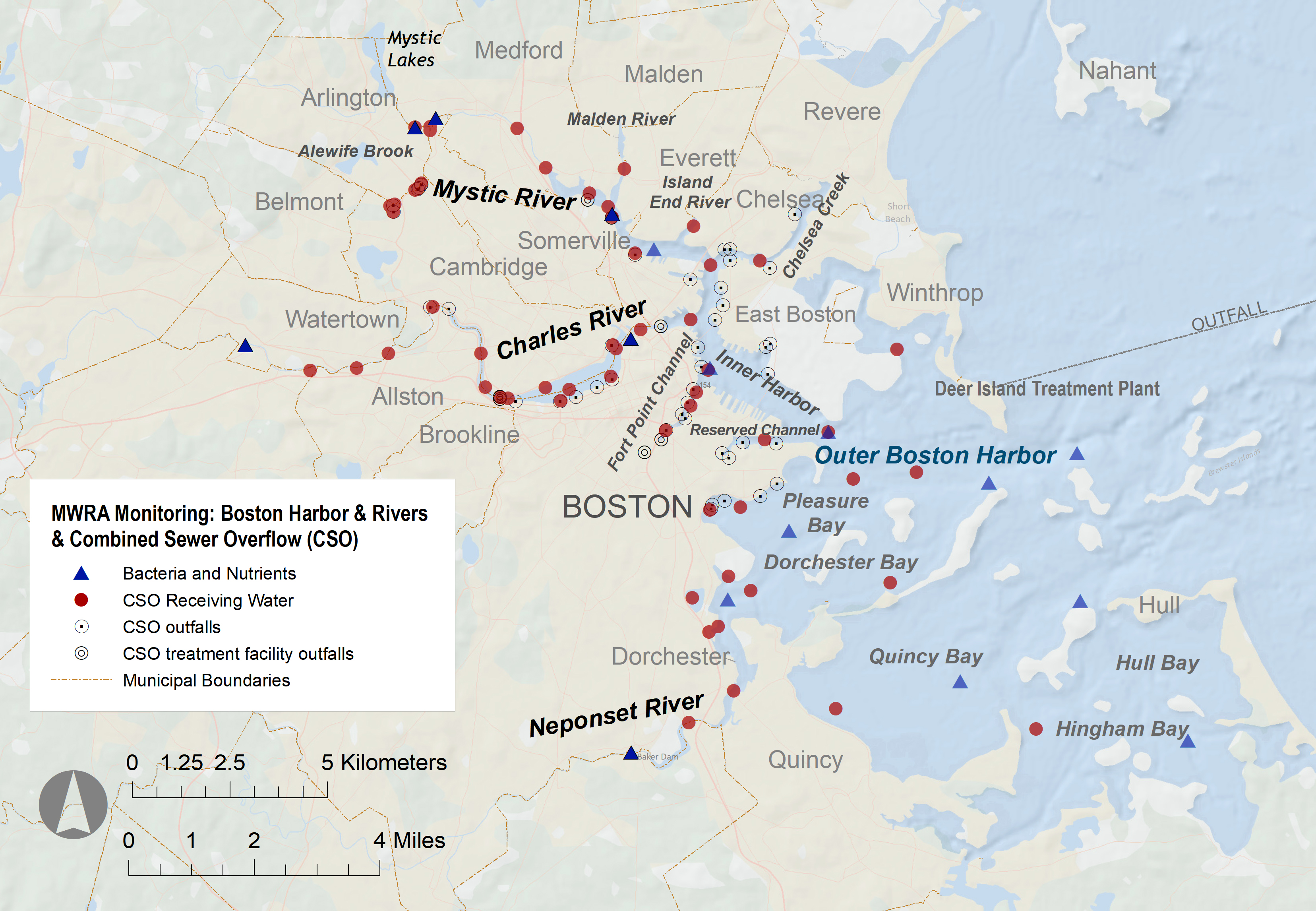
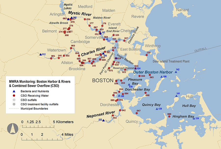
MWRA website


Boston Harbor and Massachusetts Bay
MWRA Environmental Quality Department

Boston Harbor and the Tributary Rivers

Boston Harbor Page Harbor Beaches Page Charles River Page Mystic River Page Neponset River Page
Boston Harbor Beaches Charles River Mystic River Neponset River


INNER HARBOR SURFACE TEMPERATURE RANGE: 53-61° F


ABOUT BOSTON HARBOR

Boston Harbor encompasses nearly 50 square miles and is an estuary, where fresh water from tributary rivers mix with the salt water of Massachusetts Bay.

The Massachusetts Water Resources Authority monitors water quality at more than 50 locations in Boston Harbor. Measurements are also made in the Charles, Mystic, and Neponset rivers. The monitoring program is designed to monitor the impacts of combined sewer overflows (CSOs) on the Harbor and rivers.

Click on this Boston Harbor sampling map for additional stations and station numbers
See larger map with sampling locations


Water Quality Parameter

Historic Range for Boston Harbor*

Data

Dissolved Oxygen

1.29 -  14.31 mg/L   Mean: 7.54
(7886 readings)

Download physical data

Temperature

46.2 -  74.9 deg F   Mean: 60.9
(7978 readings)

Salinity

0.29 -  33.73 PSU   Mean: 29.75
(7800 readings)

pH

6.47 -  9.95   Mean: 7.82
(6922 readings)

secchi disk2.jpg

Secchi Disk Depth

0.2 -  6.9 m   Mean: 2.39
(3300 measurements)

Download clarity data

TSS
0.37 -  20.2 mg/L   Mean: 3.85
(1981 samples)

algae-bloom-charles.jpg

Nutrient Chemistry

DIN: 0.03 -  27.5 umol/L   Mean: 3.15(783 samples)

Download nutrient data

Chlorophyll & Phaeophytin

Chl a: 0.53 -  18.4 umol/L   Mean: 3.75
(1994 samples)

Fecal_Coliform_Plate.jpg

Enterococcus

0 -  169000 count/100 mL  Geo. mean: 2
(4531 samples)

Download bacteria data

E. coli

0 -  261000 count/100 mL  Geo. mean: 3(2372 samples)

Fecal coliform

0 -  968000 count/100 mL  Geo. mean: 7(2706 samples)


Questions or comments? Email us